← All projects
Web mapping
Interactive maps
A terrain-game map for SGGW Days and interactive web maps built with Python and Folium.
I have experience creating interactive maps that can be presented in both standard and digital formats.
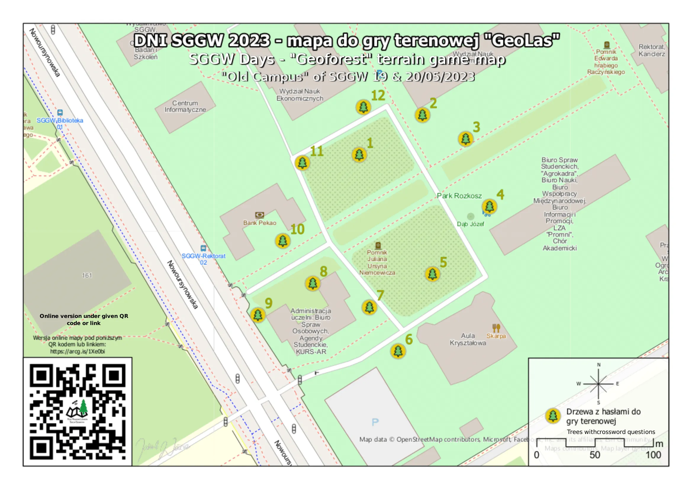
I developed the interactive map for a terrain game at “SGGW Days”, an event that promotes the Faculty of Forestry alongside the other faculties of Warsaw University of Life Sciences (WULS). The event is held every May on the WULS campus.